Parched

I’m sure many other people here, like me, feel deeply affected by the August 2022 heatwave – we have a lot of reservoirs in the West Pennine Moors and I’m shocked at just how low the water levels are at the moment. So, I decided to take a tour of the ones local to me and undertake a sort of ‘photo audit’.
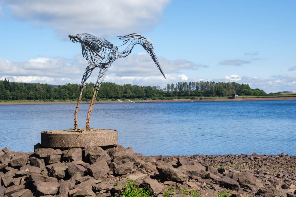
I first decided to embark on this project a few weeks ago when I headed out for a walk around Entwistle and Wayoh reservoirs. The stately heron sculpture, created by local artist Marjan Wouda, which usually stands in deep Entwistle water, was completely exposed, showing the rubble mound and the concrete plinth that it’s secured to.
Wayoh didn’t look much better either, with large areas of the reservoir bed visibly turning green as nature takes hold of the nutrient rich mud.
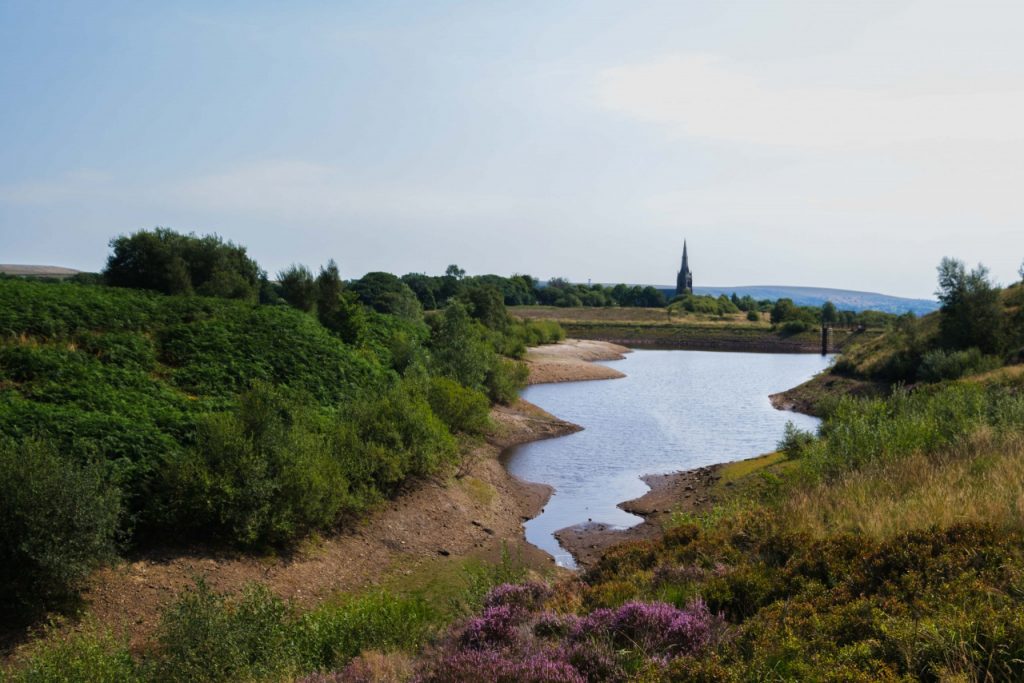
Ward’s Reservoir in Belmont is a place I enjoy photographing, especially at sunset or sunrise to capture the sky’s reflections on the water’s surface. For this shot below, with the church in the distance, I’m stood in exactly the place I’d stand for sunrise shots and I’m amazed at how much the water has receded from its normal levels.
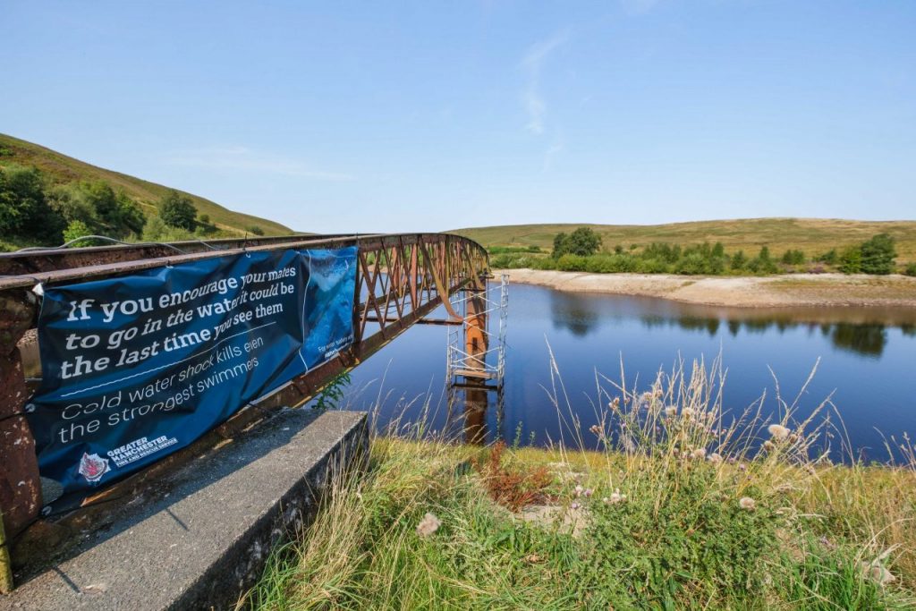
From the pier at the other end of the reservoir, it’s a bit clearer just how much the water levels have fallen, with the usual water levels visible in the difference of colours on the support at the end.
A place I also wanted to check out was the nearby Belmont Reservoir. I often drive past and love seeing the island that surprisingly attracts so many seabirds. From the road, it almost looked as though the channel between the island and the reservoir shoreline had disappeared entirely, so I went for a closer look.
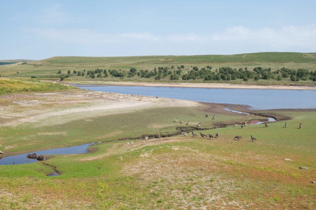
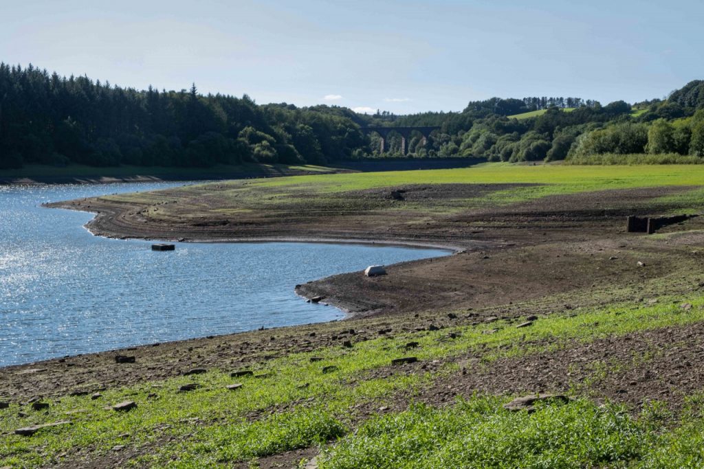
Fortunately, that wasn’t the case, but as you can see from this view, much of the reservoir appears more like a pasture – all this area would normally be covered in water, so it shows the full extent of its retreat away from the reservoir wall on Belmont Road.
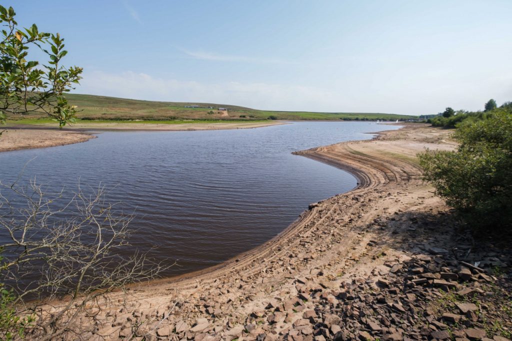
Below is a view looking south towards the village along the roadside wall, where the arid slopes of the reservoir almost resemble a desert landscape, especially with the dried out skeleton of a shrub in the foreground.
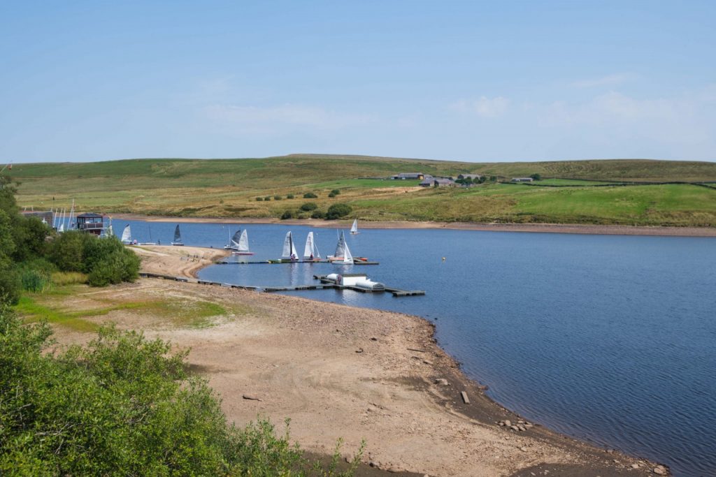
Summer months must be busy for the Belmont sailing club, so it was at least reassuring to see usual club activities taking place that weekend, despite the reduced capacity of the reservoir.
Later that day, I drove further up the Belmont Road to walk around the two Roddlesworth Reservoirs. Bear in mind, the temperature was still high, around 28 and 29 degrees centigrade, so it made sense to find a bit of shape in the woodland paths around these.
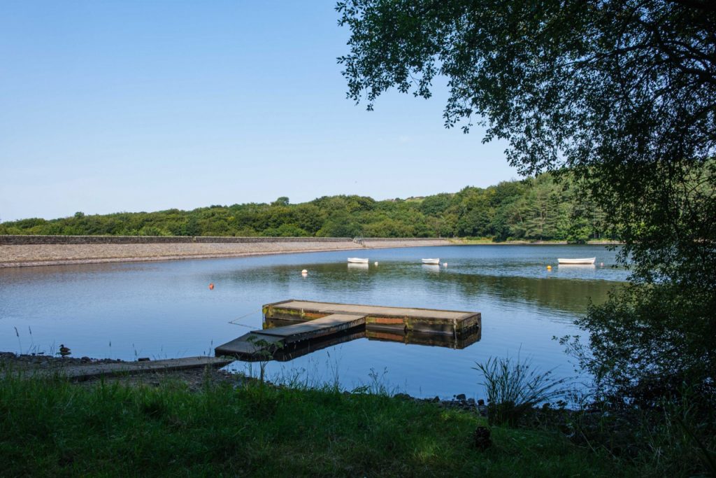
Upper Roddlesworth Reservoir is home to the Horwich & District Fly Fishing Cub and I often stop here for a moment to take in the view – there’s something so calming about seeing this floating platform and the moored boats that belong to the club. With the walls of the reservoir in the distance, you can see the dark line that indicates the usual levels of the water, so it actually doesn’t look too bad from this perspective.
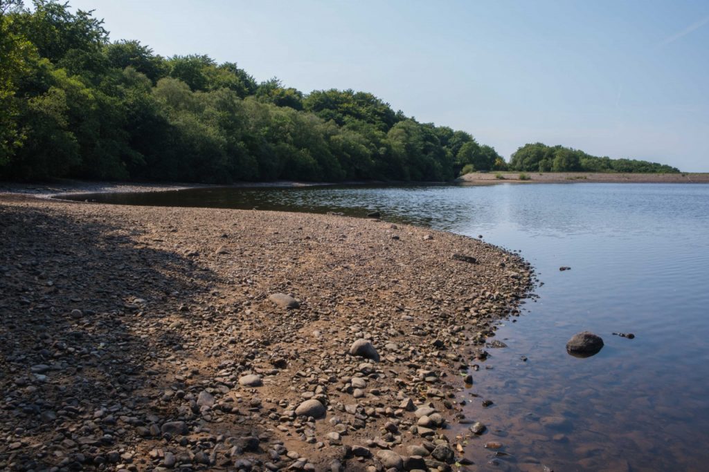
Lower Roddlesworth Reservoir gave a different perspective though. There are large exposed beach areas along the western shoreline.
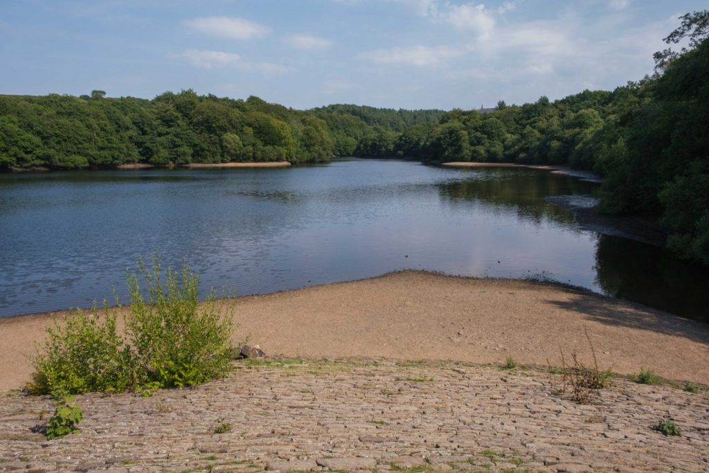
The same is true once you reach the northern wall of that reservoir. Large tracts of the reservoir bed are exposed here too.
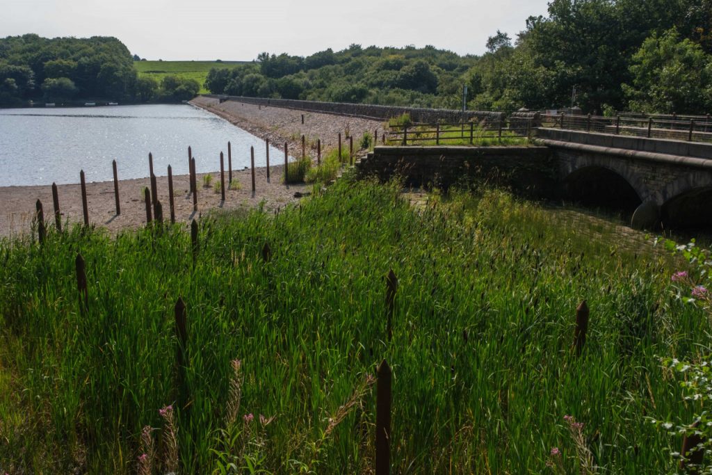
This is the opposite corner of the northern reservoir wall and this whole area is usually submerged, with just the top couple of feet of these bullrushes and the stakes visible above the water line.
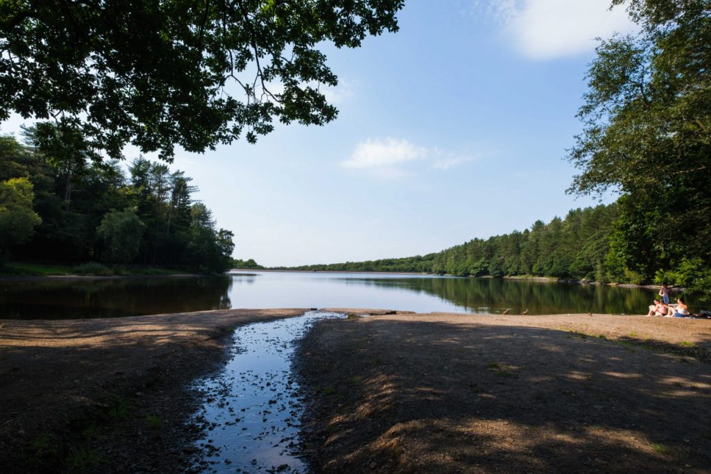
This image from the southern end of Upper Roddlesworth completes my walking loop of the two reservoirs. The family group in the shade to the right in the image enjoying a summer’s day out make this look quite idyllic and it almost normalises the fact that we’re experiencing some of the worst drought conditions since 1976.
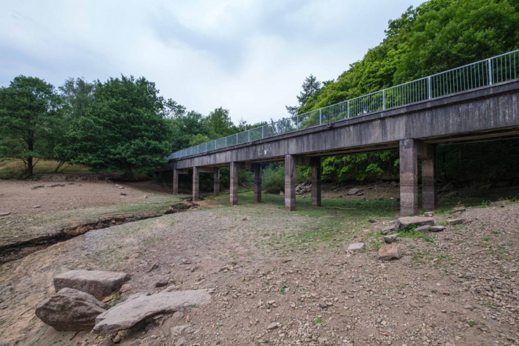
The next evening I visited Jumbles Reservoir. The woodland paths around it are normally busy with walkers, runners and families out for a stroll, but the paths that evening were eerily quiet, matched in mood by the emptiness of the reservoir itself.
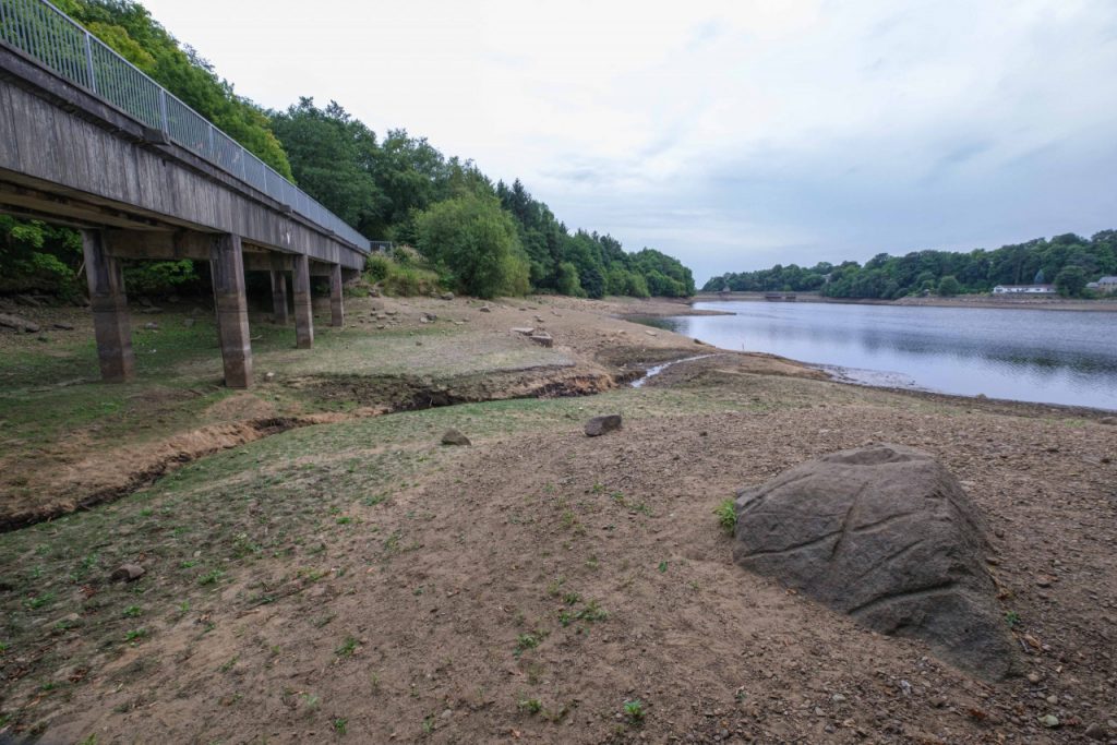
The two photos above are of the bridge that’s oriented in a north-south direction on the eastern shore.
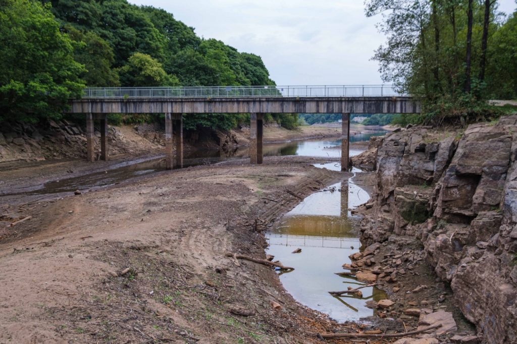
These shots above and below are of the east-west oriented bridge at the northern edge of the reservoir. Shockingly, there’s now just a small channel of water flowing under the bridge. I could even get right on to the bed of the reservoir to take these shots.
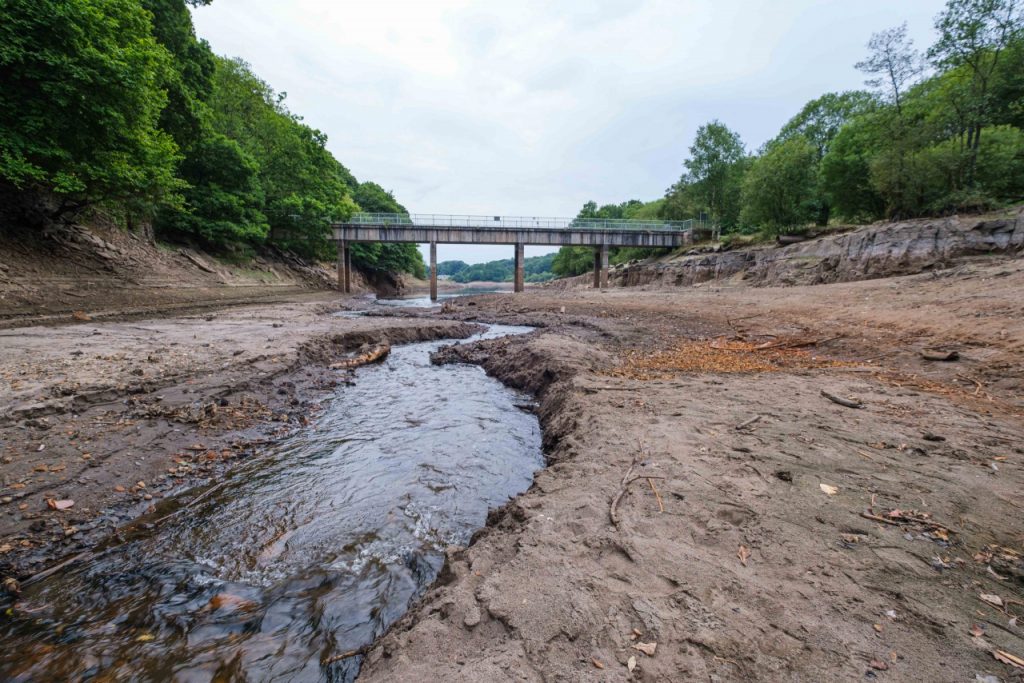
It’s going to take a lot of rain to get these reservoirs back to their usual levels but, of course, we are located here in one of the wettest parts of the country, so let’s hope enough rain is on its way.
These photos are just a snapshot of something that, to me, seems unusual. Whilst I certainly do believe that climate change is real, it’s not my intention to fuel that debate, nor am I seeking to put this in an apocalyptic context – one of a series of disasters sandwiched between a pandemic and an economic crisis.
I’ve not lived here long enough to know just how often we experience droughts like this, but it does seem quite extreme and it feels appropriate to record this event. Hopefully I can revisit this idea in a few years and things will not be quite as bad . . .

Really powerful and valuable piece of documentation Julia. It will serve as a yardstick for future events. We take our usually plentiful rainfall for granted here in the NorthWest. These events help us appreciate how other, less fortunate areas are suffering under a rapidly changing climate.
We have more rain forecast after next week so hopefully these low levels will slowly start to improve.
Thanks for documenting this.
Hi Denise – thanks very much for your thoughtful comment and sorry it’s taken me so long to respond. Yes, its something I intend to keep an eye on, albeit rather unscientifically but I agree, I thought it was an unusual and important situation to document.